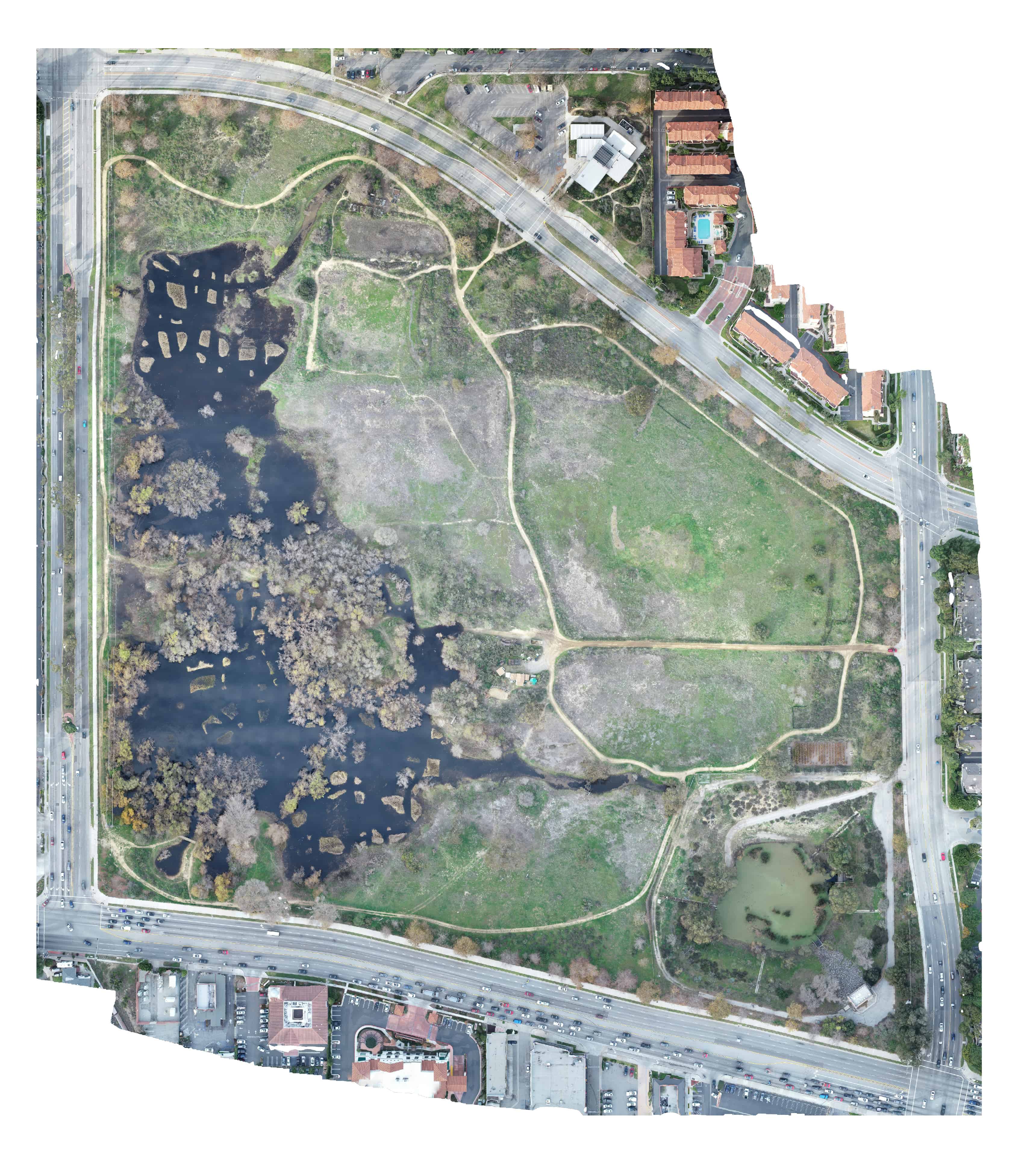
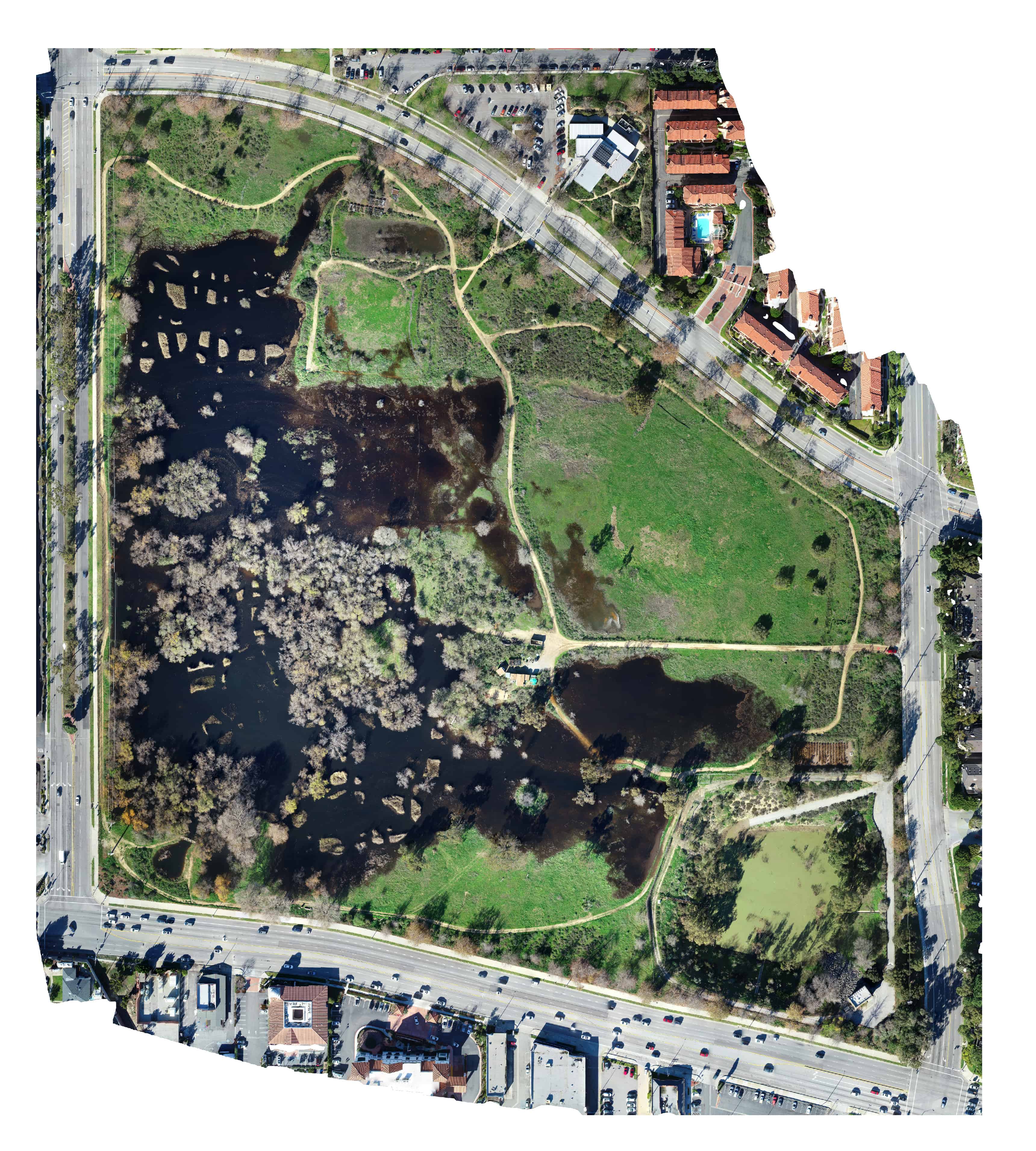
Madrona Marsh – First Storm of 2019
See the power of 2D Mapping…. check out what the Madrona Marsh looked like before and after a string of storms. These images were created by combining 399 drone photographs into a uncorrected orthomosaic image. Do you have a remodel, construction project or even a wildlife preserve you want to track over time? Sky Ladder Drones can help you create high definition maps — and you control when and where you share the maps. And, by combining the services of a licensed surveyor, these maps turn from pretty pictures to a useful tool. Give us a call or drop us an email.
")
